OK, tonight was marked by the maiden voyage of my new Forerunner 201. I didn't have any trouble getting it to synch with the satellites and didn't mess with laps or anything - just put it on and ran once around the lake like I did on Tuesday. Being able to see the miles tick off was great. I now know where the first mile mark is, the second, when I have reached the halfway point, etc.
Even though it was a good 20 degrees warmer today I was able to push it and run about as quickly. In fact, when I finished I was surprised to find that I was only 14 seconds slower for the entire run. The biggest surprise was that were the Parks Dept. website lists the trail length as being 3.57, Garmin measured 3.77. I don't know how the Parks people did their measurements. Did they follow the trail as it cuts in and under the various street bridges or did they simply circle the lake, cutting across the streets? I also don't how accurate the Forerunners are. What should I do - trust the government or my own electronics?
Thursday, August 25, 2005
Subscribe to:
Post Comments (Atom)

6 comments:
there's a couple things to take note of with the forerunner. it is pretty acurate. but that doesn't always match how the measurements of something have been taken. like in a race. the course designers are always mapping shortest distance, but we don't always run shortest distance. i've heard runners during a race exclaim, "those mile markers are off!" simply because they're relying on their gps unit.
apply the run data from the forerunner to a mapping program and you'll be able to tell if the run accurately recorded your path. sometimes there's weird spikes in location that will add mileage. happens to me in california on occasion, but rarely out of state.
i use topofusion for all my mapping, but i'm sure there's a googlemaps hack out there somewhere, since the xml data that the training center software (download the garmin software for the 301 - it's much better than the 201 software) can export holds the exact long/lat info that googlemaps uses.
a couple pointers, too, set up the auto lap to one mile, if it isn't already. that'll allow you to use the lap screen and see what your current mile pace is. set the pace smoothing to maximum, too. the forerunner has a tendency to fluctuate the pace, but the lap screen will show a more accurate, updated pace for the overall mile.
give me a holler if you have any other questions about it. this comment is getting much too wordy.
=)
Ya, set your lap to one mile. Totally. Then you get the little beep at every mile, and can glance down and see what your pace was for that mile. I set up my "custom" screen with my average mile pace, thus I can see if I need to ramp it up, or can relax.
I'd trust your forerunner. Might as well...you won't always be running around the lake.
Like Jeff said, set that pace update satelite checkin thingo to be as sensitive as possible.
I think 0.2 miles is an acceptable discrepency over 3.5 miles...maybe your next trip will show it as 3.3 or something...anyhow. Repition...more data points. Woot.
I don't use the features properly, I just do the basic timing / pace thing. I have noticed that it gives me different figures sometimes for different runs. I wonder why? Is it because maybe I go on the outside of a road instead of the inside, and that lengthens the route? Jeff's idea of using a mapping program (maybe MapPoint) sounds like a great one, plus it's really interesting to see the data overlaid.
Interesting to see you blog about the Forerunner. I got lost on my run on Thursday, and I've been looking at the Forerunners since then.
From what I gather, it's not really for directions and maps, but I think its rudimentary "bread crumb" map should be good enough. However, once I started looking into it, the whole training analysis side of it is really exciting.
I'd like to see how you feel about it after the next week or two. Keep us posted.
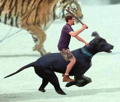
i don't use gadgets in any of my runs but i wanted to comment on the hysterical pic of you on dog. oh to be computer savvy!
TRUST THE GOVERNMENT??? Are you mad? (just joking, george)
I love mine and have found it to be really accurate.
I use a program called SportTracks (free download) and it works great. It imports google maps to lay under your runs (or satellite photos, or topos. whatever you are into).
Try it, I bet you will like it!
Post a Comment